By Rebecca Martin
Since the Draft Scope for the proposed Lincoln Park Grid Support Center project (a gas-fired power plant in the Town of Ulster) was released on February 1, citizens have been focused on improving the document with many generous not-for-profit partners and experts who have provided support and assistance.
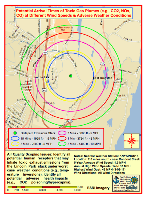
One of those experts is the Hydrologist / Hydrogeologist Paul A. Rubin, who spent all day yesterday at a weather station nearest to the proposed site, to create the following maps that can help us to identify air quality scoping items.
“I focused on finding and assessing data from the nearest weather station with wind velocity and direction data (available through Weather Underground: KNYKINGS15). This Kingston weather station is approximately 13,590 ft south of the proposed emission tower (~ 2.57 miles; elevation: 138 ft msl). I reviewed five years of weather data and selected assorted wind speeds as a basis to calculate wind/emissions arrival times outward from the proposed emissions stack, downloaded imagery data, and generated the attached maps using GIS technology. The only difference between the three attached maps is the background base.The assorted colored circles represent example emission plume arrival times for assorted wind speeds. Arrival of stack gases at the outer rings would require worst-case temperature inversion conditions with minimal wind dispersion.”
Air Quality Scoping Issues: Identify all potential human receptors that may inhale toxic exhaust emissions from the Lincoln Park stack under worst case weather conditions (e.g., temperature inversions). Identify all potential adverse health impacts (e.g., CO2 poisoning/hypercapnia).
(Click on link or image for full map)
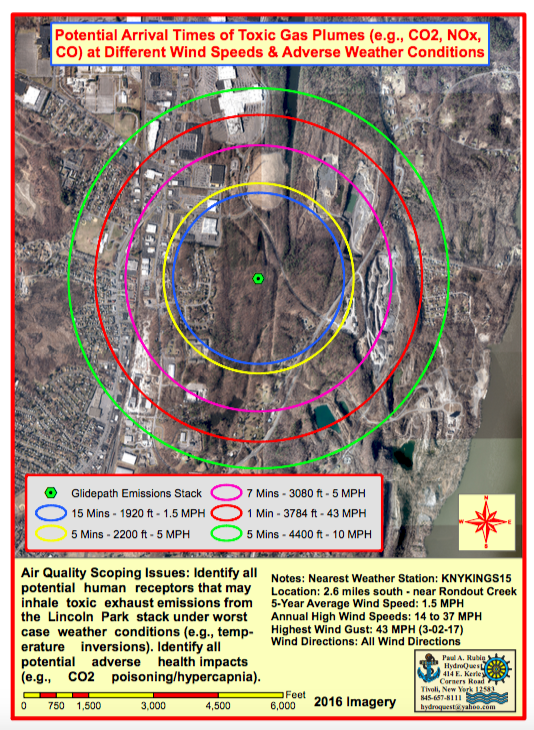
(Click on link or image for full map)
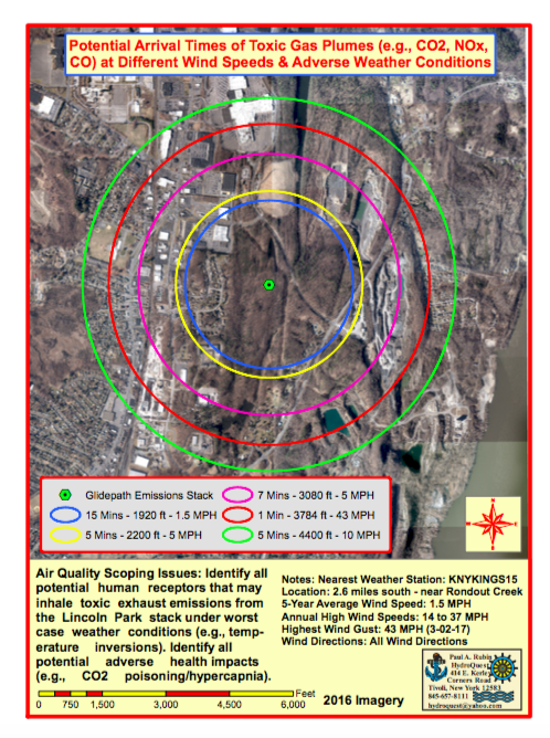
(Click on link or image for full map)